


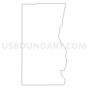
Garrison 16 Voting District, Millard County, Utah
About
Outline
Summary
| Unique Area Identifier | 678932 |
| Name | Garrison 16 Voting District |
| County | Millard County |
| State | Utah |
| Area (square miles) | 2,307.24 |
| Land Area (square miles) | 2,268.83 |
| Water Area (square miles) | 38.41 |
| % of Land Area | 98.34 |
| % of Water Area | 1.66 |
| Latitude of the Internal Point | 39.05361820 |
| Longtitude of the Internal Point | -113.72332810 |
Maps


Graphs
Select a template below for downloading or customizing gragh for Garrison 16 Voting District, Millard County, Utah


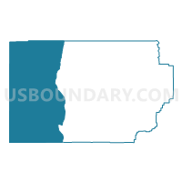
Neighbors
Neighoring Voting District (by Name) Neighboring Voting District on the Map
- Abraham 14 Voting District, Millard County, UT
- Callaco Voting District, Juab County, UT
- Kanosh 4 Voting District, Millard County, UT
- Milford 2 Unincorporated Voting District, Beaver County, UT
- Precinct 4 - Pioche, Lincoln County, NV
- WP COUNTY MAILING VTD 10, White Pine County, NV
- WP SNAKE VALLEY VTD 9, White Pine County, NV
Top 10 Neighboring County Subdivision (by Population) Neighboring County Subdivision on the Map
- Pioche CCD, Lincoln County, NV (2,684)
- Milford-Minersville CCD, Beaver County, UT (2,678)
- Baker CCD, White Pine County, NV (363)
- West Juab CCD, Juab County, UT (187)
- Garrison-Sevier Lake CCD, Millard County, UT (160)
Top 10 Neighboring Unified School District (by Population) Neighboring Unified School District on the Map
- Millard School District, UT (12,503)
- White Pine County School District, NV (10,030)
- Beaver School District, UT (6,629)
- Lincoln County School District, NV (5,345)
- Tintic School District, UT (879)
Top 10 Neighboring State Legislative District Lower Chamber (by Population) Neighboring State Legislative District Lower Chamber on the Map
- Assembly District 36, NV (59,012)
- Assembly District 35, NV (51,108)
- State House District 73, UT (34,070)
- State House District 68, UT (31,934)
Top 10 Neighboring State Legislative District Upper Chamber (by Population) Neighboring State Legislative District Upper Chamber on the Map
- Rural Nevada Senatorial District, NV (97,335)
- State Senate District 28, UT (94,905)
- State Senate District 24, UT (85,639)
Top 10 Neighboring 111th Congressional District (by Population) Neighboring 111th Congressional District on the Map
- Congressional District 3, UT (966,232)
- Congressional District 1, UT (906,660)
- Congressional District 2, NV (836,562)
Top 10 Neighboring Census Tract (by Population) Neighboring Census Tract on the Map
- Census Tract 102, Juab County, UT (4,681)
- Census Tract 9742, Millard County, UT (3,037)
- Census Tract 1002, Beaver County, UT (2,811)
- Census Tract 9501, Lincoln County, NV (2,684)
- Census Tract 9701, White Pine County, NV (1,882)